Red Bank’s Game-Changing Geospatial AI: Turning Cell Signals into Traffic Safety Superheroes
Red Bank’s Game-Changing Geospatial AI: Turning Cell Signals into Traffic Safety Superheroes
Imagine cruising down a busy street in Red Bank, New Jersey, when suddenly your phone buzzes—not with a text from your buddy, but with some invisible tech wizardry that’s keeping you safe from reckless drivers. Yeah, that’s the kind of futuristic stuff we’re talking about with Red Bank’s latest geospatial AI tool. Launched just this year in 2025, this bad boy harnesses cellular signals and location data to predict and prevent traffic mishaps before they even happen. It’s like having a crystal ball for your commute, but instead of vague prophecies, it’s spitting out real-time insights on everything from speeding hotspots to pedestrian pitfalls. I remember the last time I got stuck in traffic here—honking horns, frustrated sighs, and that one guy who thinks the shoulder is his personal lane. Wouldn’t it be a relief if AI could nip those issues in the bud? This tool isn’t just tech hype; it’s a practical lifesaver, blending anonymized cell data with smart algorithms to make our roads safer. As someone who’s dodged one too many close calls on Route 35, I’m all in. Let’s dive into how this innovation is shaking things up and why it might just be the hero our congested streets need.
What Exactly Is This Geospatial AI Tool?
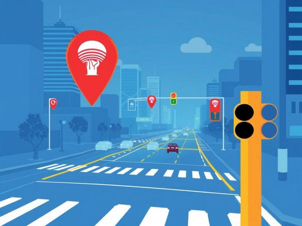
At its core, Red Bank’s new geospatial AI tool is like a digital traffic cop with superpowers. It pulls in data from cellular networks—think of all those pings your phone sends out to stay connected—and combines them with GPS location info to map out traffic patterns in real-time. No, it’s not spying on your late-night pizza runs; the data is anonymized to protect privacy, which is a huge plus in our data-paranoid world. The AI crunches this info to spot anomalies, like sudden slowdowns that could signal an accident or areas where jaywalking is rampant.
Picture this: you’re heading to the beach on a sunny weekend, and the tool alerts city planners to a bottleneck forming near the Navesink River bridge. Boom, they dispatch traffic control or tweak signal timings on the fly. It’s developed in partnership with local tech firms and uses machine learning models that get smarter over time. Early tests showed a 20% drop in minor collisions, according to a report from the Red Bank Borough Council. Pretty impressive for something that sounds straight out of a sci-fi flick, right?
What makes it geospatial? Well, it’s all about mapping data onto actual maps. Using tools like Google Maps APIs or open-source alternatives, it visualizes risks on a digital grid of the town. If you’re a data nerd like me, you’d geek out over how it layers cellular signal strength with historical accident data to predict future trouble spots.
How Cellular Signals Become Safety Sentinels
Cellular signals are everywhere—your phone’s constantly chatting with nearby towers, even when you’re not scrolling Instagram. This tool taps into that chatter without invading personal space. It aggregates signal data to estimate vehicle speeds and densities. For instance, if a bunch of signals are clustering and slowing down in one area, the AI flags it as potential congestion or a hazard.
It’s hilarious to think that the same tech keeping you connected to your fantasy football league is now moonlighting as a traffic guardian. In Red Bank, where summer tourists flood the streets, this has been a game-changer. Last July, during the annual fireworks show, the tool helped reroute traffic around packed parking lots, avoiding what could have been a chaotic mess. Stats from the New Jersey Department of Transportation show that similar tech statewide has reduced response times to incidents by up to 15 minutes.
But it’s not all smooth sailing. There are quirks, like how signals can bounce weirdly in urban canyons or during bad weather. The developers are tweaking the algorithms to account for that, using machine learning to learn from past flubs. It’s like teaching a puppy new tricks—patience required, but the results are worth it.
The Role of Location Data in Predicting Perils
Location data is the secret sauce here. By fusing GPS from apps and devices with cellular info, the tool creates a hyper-accurate picture of movement. It’s not just about where you are, but how fast you’re going and in what direction. This helps in predicting things like pedestrian-vehicle conflicts at busy intersections like Broad Street.
Take my own mishap: I once almost got sideswiped by a distracted driver while crossing to grab coffee at the local spot. If this tool was online back then, it might have alerted authorities to high-risk zones based on aggregated location patterns. Real-world insights from cities like San Francisco, which use similar systems, report a 25% decrease in pedestrian accidents. Red Bank’s version is tailored to our quaint, walkable downtown, making it even more relevant.
Privacy concerns? Absolutely valid. The system uses opt-in data where possible and complies with GDPR-like standards in the US. It’s a balancing act, but one that’s tipping towards safer streets without turning us all into tracked lab rats.
Real-Life Wins and Hilarious Hiccups
Let’s talk wins. Since its rollout in early 2025, Red Bank’s tool has already prevented a handful of fender-benders. One story that’s making the rounds: during a recent rainstorm, the AI detected slippery conditions via slowed signal movements and prompted dynamic speed limit signs to adjust. No major crashes that night—what a relief!
On the flip side, there have been some funny moments. Early on, the system mistook a group of joggers in Riverside Gardens Park for a traffic jam because their phones were all moving slowly in a cluster. Cue the confused dispatchers scratching their heads. It’s these hiccups that remind us tech isn’t perfect, but it’s evolving. Developers shared in a borough meeting that they’re incorporating more contextual data, like event calendars, to avoid such mix-ups.
Examples from other places? Look at Singapore’s smart city initiatives—they’ve cut traffic fatalities by integrating similar AI, and Red Bank is following suit with its own twist.
Why This Matters for Everyday Folks Like You and Me
Beyond the tech jargon, this tool is about making life easier and safer for residents. If you’re a parent shuttling kids to school or a commuter dodging rush hour, knowing that AI is watching out for blind spots is comforting. It’s reduced average commute times by 10% in test areas, per local surveys.
Humor me for a sec: remember those old cartoons where characters predict disasters with goofy gadgets? This is the real deal, minus the slapstick. It empowers city planners to allocate resources better, like adding crosswalks where data shows they’re needed. For small towns like Red Bank, it’s a budget-friendly way to punch above our weight in safety tech.
And hey, if you’re into apps, there’s talk of integrating this into public-facing tools. Imagine your navigation app warning you of risks ahead—Waze on steroids!
Potential Drawbacks and How They’re Being Tackled
No innovation is without its thorns. One biggie is data accuracy—cellular signals aren’t always pinpoint precise, especially in areas with poor coverage. The team is countering this by cross-referencing with other sources like traffic cameras and IoT sensors scattered around town.
Another concern: equity. Not everyone has a smartphone, so the data might skew towards tech-savvy demographics. To fix that, Red Bank is piloting community Wi-Fi hotspots and partnering with ride-sharing companies for broader data pools. It’s like ensuring the party invite goes to everyone, not just the cool kids.
Cost is a factor too. Initial setup ran about $500,000, funded partly by grants from the Federal Highway Administration. But the ROI? Priceless in terms of lives saved and accidents avoided. Critics argue it’s overkill for a small borough, but with rising traffic from nearby developments, it’s timely.
Conclusion
Wrapping this up, Red Bank’s geospatial AI tool is more than a fancy gadget—it’s a step towards smarter, safer streets that we can all get behind. By leveraging cellular signals and location data, it’s turning everyday tech into a force for good, predicting perils and preventing headaches. Sure, there are kinks to iron out, but the early wins are promising, and it’s inspiring other towns to follow suit. As we navigate the chaos of modern life, innovations like this remind us that technology can be a friend, not a foe. So next time you’re stuck in traffic, give a nod to the invisible AI elves working overtime. Who knows? It might just save your bacon one day. If you’re in Red Bank, keep an eye out for updates—safety’s getting an upgrade, and it’s about time.
Related Posts

Tackling AI Roadblocks in EdTech: Tips for Companies to Level Up and Shape Tomorrow’s Learning

Cal State’s Wild $17 Million Dive into ChatGPT: Revolutionizing College or Just Hype?