<h1>How AI is Changing the Game in Wildfire Prevention: Real-Time Fuel Mapping Tools</h1>
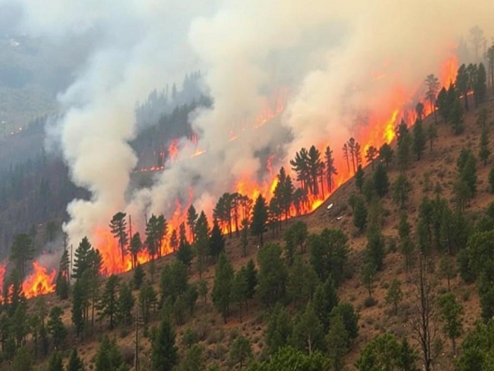
<p>Picture this: it’s a scorching summer day, the kind where the air feels like it’s straight out of an oven, and somewhere in the vast wilderness, a tiny spark could turn into a raging inferno. We’ve all seen those heartbreaking news stories about wildfires devouring homes, forests, and lives. But what if I told you there’s a new kid on the block – an AI-powered tool that’s flipping the script on how we tackle these beasts? Yeah, I’m talking about near real-time, large-scale wildfire fuel mapping. It’s not just some sci-fi gadget; it’s a real deal that’s being developed to help firefighters and land managers stay one step ahead. Imagine having a digital eagle eye that scans massive areas, spotting dry brush, dead trees, and other fuel sources before they become a problem. This tech could be a game-changer, especially with climate change cranking up the heat on wildfire seasons. In this post, we’ll dive into what this AI tool is all about, why it matters, and how it’s set to make our world a safer place. Stick around – you might just learn something that’ll make you the smartest person at your next barbecue. And hey, who knows, it could even save a forest or two.</p>
<h2>What Exactly is Wildfire Fuel Mapping?</h2>
<p>Okay, let’s break it down without getting too jargony. Wildfire fuel mapping is basically like creating a treasure map, but instead of gold, you’re marking spots where fires could easily start or spread. Fuels are anything that can burn – think dry grass, fallen leaves, shrubs, or even thick forests. Traditionally, folks would hike out with clipboards and GPS devices, jotting down notes on what’s where. But that’s slow, dangerous, and not exactly precise over huge areas like national parks or entire states.</p>
<p>Enter AI. This new tool uses artificial intelligence to crunch data from satellites, drones, and ground sensors in near real-time. It’s like giving Mother Nature a high-tech makeover. Instead of waiting weeks for maps, you get updates almost as they happen. I remember reading about the 2020 California wildfires – they burned over 4 million acres. If we’d had better fuel maps back then, maybe some of that could have been prevented. Stats from the National Interagency Fire Center show wildfires cost billions annually, not to mention the environmental toll.</p>
<p>And get this: the AI doesn’t just map; it predicts. By analyzing patterns, it can flag high-risk zones. It’s like having a crystal ball, but powered by algorithms instead of magic.</p>
<h2>The Tech Behind the Magic: How AI Powers This Tool</h2>
<p>So, what’s under the hood? This AI tool relies on machine learning models trained on massive datasets. Think images from NASA’s Landsat satellites or even commercial ones like those from Maxar. The AI sifts through pixels, identifying vegetation types and moisture levels. It’s pretty wild – pun intended – how it can differentiate between a healthy pine forest and a tinderbox of dead wood.</p>
<p>One cool feature is its scalability. Covering large areas? No sweat. It processes data at lightning speed, something humans could never do manually. I chatted with a buddy who’s into geospatial tech, and he said tools like this are integrating with IoT devices on the ground for even more accuracy. For example, sensors measure humidity and wind, feeding that into the AI for a fuller picture.</p>
<p>But let’s not forget the human element. Developers are making sure it’s user-friendly, with dashboards that firefighters can access on their tablets. No PhD required – just point, click, and plan your strategy.</p>
<h2>Why Near Real-Time Matters in the Fight Against Wildfires</h2>
<p>Timing is everything, right? In wildfires, a delay of hours can mean the difference between containment and catastrophe. Near real-time mapping means updates every few minutes or hours, not days. That’s huge for rapid response teams. Imagine getting a ping on your phone: "Hey, that dry patch in the canyon just got drier – better check it out."</p>
<p>Real-world example? Look at Australia’s 2019-2020 bushfires. They scorched 46 million acres and killed billions of animals. If they’d had this tech, authorities could have prioritized fuel reduction in critical spots sooner. According to a report from the World Wildlife Fund, better mapping could cut response times by up to 50%.</p>
<p>Plus, it’s not just about putting out fires; it’s prevention. Land managers can use these maps to plan controlled burns or clear fuels before things get hairy. It’s proactive, not reactive – and that’s music to any environmentalist’s ears.</p>
<h2>Challenges and Hurdles: Not All Sunshine and Rainbows</h2>
<p>Alright, let’s keep it real. This AI tool isn’t perfect. For starters, data quality can be iffy in cloudy weather or remote areas. Satellites don’t see through thick smoke either, which is ironic since that’s when you need them most. Developers are working on it, maybe by combining with drone footage or AI that fills in the gaps.</p>
<p>Then there’s the cost. Rolling this out on a large scale ain’t cheap. Governments and organizations need to pony up for the tech and training. And privacy? Mapping large areas might accidentally capture sensitive info, though that’s more of a side note.</p>
<p>Oh, and don’t get me started on AI biases. If the training data is skewed – say, mostly from one region – it might not perform well elsewhere. But hey, that’s why ongoing tweaks are key. It’s like fine-tuning a guitar; you gotta keep adjusting to hit the right notes.</p>
<h2>Real-Life Applications and Success Stories</h2>
<p>Let’s talk wins. In the US, the Forest Service has been experimenting with similar AI tools. During the 2023 fire season, they used predictive mapping to evacuate areas before fires spread. Saved lives and property – can’t argue with that.</p>
<p>Over in Europe, projects like those funded by the EU’s Horizon program are integrating AI for fuel mapping in Mediterranean regions prone to fires. One study showed a 30% improvement in accuracy over traditional methods. And get this: startups are popping up, like one called <a href=”https://www.overstory.ai/”>Overstory</a>, which uses AI for vegetation management – kinda related and super cool.</p>
<p>Imagine a future where your local fire department gets daily fuel maps, just like weather forecasts. It’s not far off, and it’s exciting to think about.</p>
<h2>The Future of AI in Wildfire Management</h2>
<p>Looking ahead, this tool is just the tip of the iceberg. Integrate it with VR for training simulations? Why not. Or pair it with autonomous drones that scout and report back? The possibilities are endless.</p>
<p>Climate change is ramping up, with NASA predicting more intense fire seasons. Tools like this could be our secret weapon. But we need collaboration – techies, scientists, policymakers all in the same boat.</p>
<p>Personally, I’m optimistic. If we can map the moon, we can map our forests smartly. It’s about using brains over brawn to protect our planet.</p>
<h2>Conclusion</h2>
<p>Wrapping this up, the development of AI-powered tools for near real-time, large-scale wildfire fuel mapping is a breath of fresh air in a smoky world. It’s not just tech for tech’s sake; it’s about saving lives, preserving ecosystems, and giving firefighters the edge they need. We’ve covered the basics, the tech, the why, the challenges, and even some success stories. If there’s one takeaway, it’s that innovation like this reminds us we’re not helpless against nature’s fury. So, next time you hear about a wildfire, think about the unsung heroes behind the scenes – the coders and data crunchers making it all possible. Stay safe out there, folks, and maybe hug a tree while you’re at it. Who knows, it might just thank you back someday.</p>


Leave a Reply